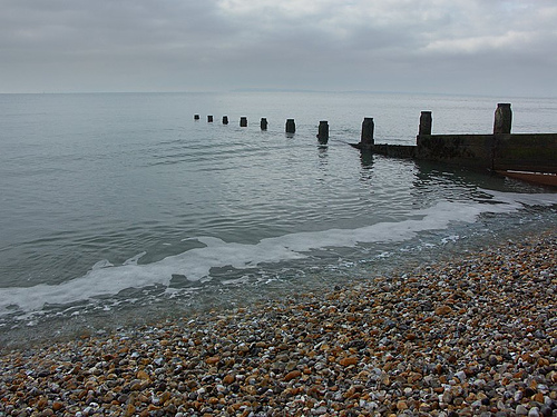
Bracklesham Bay is a 200.6-hectare (496-acre) biological and geological Site of Special Scientific Interest in West Sussex. It is a Geological Conservation Review site. Bracklesham is a coastal bay on the west side of the Manhood Peninsula in West Sussex, England. The bay looks out onto the English Channel and the Isle of Wight is visible from the beach, as is the Nab Tower lighthouse and the Spinnaker Tower in Portsmouth. The villages of Bracklesham and East Wittering are situated in the centre of the bay and it is bordered by the town of Selsey on the southeastern tip, and the village of West Wittering on the west side.
The shingle strand that frames Bracklesham Bay is not just a backdrop for seaside strolls; it is a living textbook of the Eocene epoch. A short walk from the car park reveals sediment layers that shift colour and texture underfoot, each telling a story of ancient marine life and climatic change. Bring a field guide or a simple hand‑lens to examine fossilised shells and occasional shark teeth that surface after a tide. The best time for this natural fieldwork is low tide in early autumn, when the water recedes far enough to expose the stratified cliffs without the crowds of summer beachgoers.
While the cafés lining the promenade serve the expected battered cod, the villages that ring the bay harbour a quieter culinary tradition. In Bracklesham, pop into the modest tea room that sources its scones from a family farm in the South Downs, and try the locally pressed apple cider, a crisp companion to the area’s mushroom foraging season. East Wittering’s weekly market, held on Saturdays, offers hand‑rolled pastry filled with Sussex lamb, a subtle nod to the county’s pastoral heritage. These modest indulgences give a fuller taste of the coast beyond the tourist‑focused menus.
Bracklesham Bay sits in a subtle contrast to its more celebrated neighbours such as Brighton or the iconic cliffs of Dover. Its shoreline is flatter, with expansive shingle intertidal zones that invite long, uninterrupted walks rather than dramatic cliff‑top vistas. The view of the Isle of Wight across the channel is framed by a gentle horizon, offering a calmer visual rhythm. For travellers seeking a coastal experience that feels less staged and more attuned to natural processes, Bracklesham provides a measured alternative to the bustling promenade culture of larger seaside towns.
Bay in West Sussex, United Kingdom Bracklesham BaySite of Special Scientific InterestLocation of Bracklesham Bay.LocationWest SussexGrid referenceSZ 814 954InterestBiologicalGeologicalArea200.6 hectares (496 acres)Notification1986Location mapMagic Map Bracklesham Bay is a 200.6-hectare (496-acre) biological and geological Site of Special Scientific Interest in West Sussex. It is a Geological Conservation Review site. Bracklesham is a coastal bay on the west side of the Manhood Peninsula in West Sussex, England. The bay looks out onto the English Channel and the Isle of Wight is visible from the beach, as is the Nab Tower lighthouse and the Spinnaker Tower in Portsmouth. The villages of Bracklesham and East Wittering are situated in the centre of the bay and it is bordered by the town of Selsey on the southeastern tip, and the village of West Wittering on the west side.
[edit] This stretch of foreshore has unimproved grazing pastures, shingle, salt marsh, reed beds and ditches. The pasture is subject to seasonal flooding and it is important for its breeding and overwintering birds. The site has highly fossiliferous Eocene (56 to 34 million years ago) beds with over 160 fish species. There are also much more recent Middle Pleistocene marine deposits dating to around 500,000 years ago which provide a record of changes in sea levels.
[edit] Medmerry realignment scheme (geograph 4791022) The earth embankment at Medmerry holding back the sea was originally built in the 1960s; however the coastline in the area was subject to frequent flooding events which were becoming unsustainable. The scheme arose out of consultations from the 2008 Pagham to East Head Coastal Defence Strategy with the managed realignment scheme being adopted. In 2013 the Environment Agency completed the new 7 km inland floodbank and breach in the shingle wall to providing flood relief and this enabled creation of the form the Medmerry RSPB nature reserve. The scheme cost £28 million and was the largest open-coast scheme in Europe and understood to be one of the most sustainable projects the Environment Agency has completed. A willow and wire woven periwinkle art installation was created by environmental artists Mark Antony Haden Ford and Rebecca Ford. It has been mistaken by some visitors as depicting the poop emoji.